-
play_arrow
LIVE Radio The Caribbean Sound

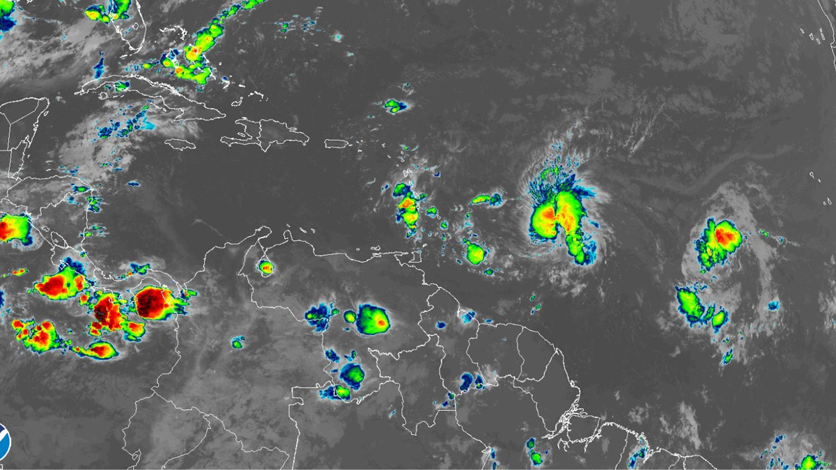
Bret is forecast to approach the Lesser Antilles through Thursday morning and then move across those islands Thursday afternoon and Thursday night as a strong tropical storm, bringing a risk of flooding from heavy rainfall, strong winds, and dangerous waves along the coast.
Given the uncertainty in the track and intensity forecasts, it is too early to specify the location and magnitude of where Bret’s associated hazards could occur. A Tropical Storm Watch is in effect for Barbados, Dominica, Martinique, and St. Lucia, and additional watches and warnings are likely for these and other islands in the Lesser Antilles today (June 21).
The storm’s cloud pattern consists of a ragged-looking CDO with a few very cold cloud tops, along with some banding features over the eastern semicircle. The current intensity estimate is set at 60 mph (50 knots), which is the average of subjective Dvorak estimates from TAFB and SAB. Although the overall upper-tropospheric outflow pattern remains fairly well defined, the outflow is beginning to become slightly impeded over the western portion of the circulation. An Air Force Hurricane Hunter aircraft is scheduled to investigate Bret this afternoon (June 21), and should provide a better estimate of the storm’s intensity and structure.
Some additional strengthening is possible during the next day or so, but when the cyclone moves into the eastern Caribbean Sea, the atmospheric environment is expected to become increasingly unfavorable for intensification. Dynamical guidance indicates that the flow associated with an upper-level trough over the eastern Caribbean, and a stronger trough farther west, should create a significant increase in vertical shear over Bret. As a result, the tropical cyclone is likely to begin weakening in a couple of days, and global models are in good agreement that the system will degenerate into a wave as it approaches the western Caribbean Sea. The official intensity forecast is similar to the previous one and near or a little above the model consensus.
Bret continues its mainly westward track with an initial motion of 280/14 knots. A mid-level ridge should be maintained to the north of the tropical cyclone for the next few days. This steering pattern will maintain a slightly north of due westward movement until the system dissipates. Users are reminded that NHC’s track forecasts have average errors of about 60 nautical miles at 48 hours, and it is too soon to know exactly where Bret’s center will move across the Lesser Antilles island chain.
Written by: Radio Caribbean International
Similar posts
Now On-Air
Contact Information
Office: 1-758-452-2636
ON-AIR: 1-758-452-3046
WhatsApp: 1-758-724-0008______________________________
Office: info@rcistlucia.com
Sales: sales@rcistlucia.com
Newsroom: news@rcistlucia.com
© 2026 Radio Caribbean 1982 Limited. ALL RIGHTS RESERVED


